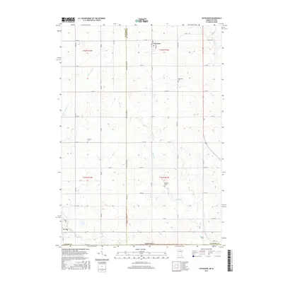
2016 Map of Ostrander
USGS Topo · Published 2016About this map
The agricultural borderlands of Mower Co and Fillmore Co are defined by the convergence of several significant headwaters along the Minnesota and Iowa boundary. The village of Ostrander serves as a local hub in the northern section, while the outskirts of Le Roy anchor the southwest corner near the Upper Iowa River. The landscape is a network of section-line roads and rolling drainage basins, where the Little Iowa River and Beaver Cr carve paths through the tillable acreage. Genealogists and local historians can find several established burial sites across these townships, including Bethany Cem, Bloomfield Cem, and the Ostrander Lutheran Cem. This map illustrates the 21st-century rural infrastructure, showing how modern county highways like CO Hwy 1 and CO Hwy 12 follow the historical settlement patterns established by early farming families in the region.
Find a feature on this map
54 named features on this map. Tap any name to fly to it.
Don’t see what you’re looking for? This feature index may not catch every label — zoom into the map to look around manually.
Map Details
Editions of this 2016 Ostrander Map
This is the sole edition of this map. No revisions or reprints were ever made.
Other maps of this area

1954 · Mason City
USGS Topo · 1:250,000

1957 · Mason City
USGS Topo · 1:250,000

1958 · Mason City
USGS Topo · 1:250,000

1965 · Le Roy
USGS Topo · 1:24,000

1965 · Wykoff
USGS Topo · 1:24,000

1965 · Spring Valley
USGS Topo · 1:24,000

1965 · Grand Meadow
USGS Topo · 1:24,000

1965 · Ostrander
USGS Topo · 1:24,000

1965 · Cherry Grove
USGS Topo · 1:24,000

1972 · Mc Intire
USGS Topo · 1:24,000