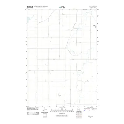
2010 Map of Otisco
USGS Topo · Published 2010About this map
The small unincorporated community of Otisco is the central focus of this landscape, situated near the headwaters of the Le Sueur River. The township retains a largely agricultural character, organized by a rigid grid of rural routes such as 290th Ave and 240th Ave. Significant local landmarks include the Otisco Post Office and the Saint Peter Cemetery, which provide vital points of reference for genealogical research in this part of Waseca County. The terrain is defined by its waterways, with Boot Creek and Bull Run Creek meandering toward the river, while Silver Lake sits in the northwest corner. A small airfield, Arneman Field, is also notable as a localized transportation feature within this quiet region of southern Minnesota.
Find a feature on this map
20 named features on this map. Tap any name to fly to it.
Don’t see what you’re looking for? This feature index may not catch every label — zoom into the map to look around manually.
Map Details
Editions of this 2010 Otisco Map
This is the sole edition of this map. No revisions or reprints were ever made.
Other maps of this area

1953 · Saint Paul
USGS Topo · 1:250,000

1954 · Mason City
USGS Topo · 1:250,000

1957 · Mason City
USGS Topo · 1:250,000

1958 · Mason City
USGS Topo · 1:250,000

1959 · Saint Paul
USGS Topo · 1:250,000

1962 · Meriden
USGS Topo · 1:24,000

1966 · Waseca
USGS Topo · 1:24,000

1966 · Janesville
USGS Topo · 1:24,000

1967 · Waldorf
USGS Topo · 1:24,000

1967 · Freeborn
USGS Topo · 1:24,000