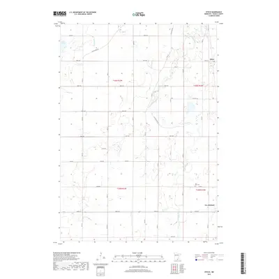
2019 Map of Otisco
USGS Topo · Published 2019About this map
The Le Sueur River meanders across this rural section of Waseca County, defining the drainage patterns of a landscape dotted with wetlands and seasonal creeks. The small settlement of Otisco sits in the northeast corner of the survey, while the northern edge of New Richland appears at the southeastern margin. This portion of southern Minnesota is characterized by a dense grid of township roads and section lines, reflecting the organized agricultural development of the region. Local history and genealogy interest is anchored by the Saint Peter Cem, located along Co Rd 12. Other natural landmarks include Silver Lake and the winding courses of Boot Cr and Bull-Run Cr, which flow through the agricultural fields and woodlots. The map provides a clear look at the intersection of early transportation routes like Wilton Bridge Rd and the more modern county road system.
Find a feature on this map
42 named features on this map. Tap any name to fly to it.
Don’t see what you’re looking for? This feature index may not catch every label — zoom into the map to look around manually.
Map Details
Editions of this 2019 Otisco Map
This is the sole edition of this map. No revisions or reprints were ever made.
Other maps of this area

1953 · Saint Paul
USGS Topo · 1:250,000

1954 · Mason City
USGS Topo · 1:250,000

1957 · Mason City
USGS Topo · 1:250,000

1958 · Mason City
USGS Topo · 1:250,000

1959 · Saint Paul
USGS Topo · 1:250,000

1962 · Meriden
USGS Topo · 1:24,000

1966 · Waseca
USGS Topo · 1:24,000

1966 · Janesville
USGS Topo · 1:24,000

1967 · Waldorf
USGS Topo · 1:24,000

1967 · Freeborn
USGS Topo · 1:24,000