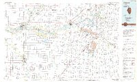
1985 Map of Ottawa
USGS Topo · Published 1985About this map
The Illinois River corridor serves as the industrial and recreational spine of this region during the mid-1980s, flowing past the manufacturing and shipping hubs of Ottawa, Marseilles, and Morris. The landscape reflects a complex transition from high-density natural preservation at Starved Rock and Buffalo Rock to the heavy industrial extraction of extensive Strip Mine operations near Coal City and Braidwood. This era sees the convergence of legacy river transport with modern infrastructure, where major arteries like Interstate 80 and Interstate 55 intersect historic rail lines like the Baltimore and Ohio Railroad. Further south, the map documents the institutional presence of the Dwight Correctional Center and the energy infrastructure of a large Gas Storage Field near Streator. From the Kankakee Bluffs to the Des Plaines Wildlife Conservation Area, this survey captures a period when river-dependent commerce and large-scale mining still defined the Grundy and LaSalle County economies.
Find a feature on this map
101 named features on this map. Tap any name to fly to it.
Don’t see what you’re looking for? This feature index may not catch every label — zoom into the map to look around manually.
Map Details
Editions of this 1985 Ottawa Map
This is the sole edition of this map. No revisions or reprints were ever made.
Other maps of this area

1890 · Des Plaines
USGS Topo · 1:62,500

1892 · Morris
USGS Topo · 1:62,500

1892 · Marseilles
USGS Topo · 1:62,500

1892 · Joliet
USGS Topo · 1:62,500

1892 · Wilmington
USGS Topo · 1:62,500

1892 · Ottawa
USGS Topo · 1:62,500

1893 · Lasalle
USGS Topo · 1:62,500

1894 · Des Plaines
USGS Topo · 1:62,500

1900 · Des Plaines
USGS Topo · 1:62,500

1901 · Des Plaines
USGS Topo · 1:62,500