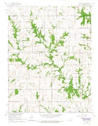
1965 Map of Ottawa NW
USGS Topo · Published 1966About this map
The Old Indian Treaty Boundary bisects the northern reaches of this rural landscape, marking a significant historical line through Appanoose and Marion townships. During the mid-1960s, this area of Kansas remained primarily agricultural, defined by the winding paths of Appanoose Creek and Eightmile Creek. Local community life was anchored by institutions like the Appanoose Sch and Appanoose Ch, while multiple Quarries indicate small-scale resource extraction in the region.
Find a feature on this map
23 named features on this map. Tap any name to fly to it.
Don’t see what you’re looking for? This feature index may not catch every label — zoom into the map to look around manually.
Map Details
Editions of this 1965 Ottawa NW Map
2 editions found
Other maps of this area

1885 · Lawrence
USGS Topo · 1:125,000

1889 · Burlingame
USGS Topo · 1:125,000

1889 · Lawrence
USGS Topo · 1:125,000

1894 · Burlingame
USGS Topo · 1:125,000

1947 · Lawrence
USGS Topo · 1:250,000

1950 · Lawrence
USGS Topo · 1:250,000

1955 · Overbrook
USGS Topo · 1:24,000

1955 · Globe
USGS Topo · 1:24,000

1956 · Pomona
USGS Topo · 1:24,000

1956 · Ottawa North
USGS Topo · 1:24,000