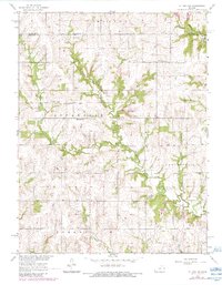
1965 Map of Ottawa NW
USGS Topo · Published 1983About this map
The Old Indian Treaty Boundary carves a diagonal path across the landscape of northern Centropolis and Appanoose, marking a significant historical line of demarcation that still influenced the layout of rural land tracts in the mid-1960s. This agricultural region at the border of Douglas County and Franklin County is defined by a network of drainage systems, most notably Appanoose Creek and Eightmile Creek. Local community life is anchored by traditional landmarks like the Appanoose School, Appanoose Church, and Eightmile Church. Genealogists will find several burial grounds mapped in detail, including Appanoose Cemetery, Pleasant Hill Cemetery, and the Kaub Cemetery. Small industrial activities such as a quarry appear near the creeks, while the township of Marion occupies the northernmost reaches of this survey.
Find a feature on this map
19 named features on this map. Tap any name to fly to it.
Don’t see what you’re looking for? This feature index may not catch every label — zoom into the map to look around manually.
Map Details
Editions of this 1965 Ottawa NW Map
2 editions found
Other maps of this area

1885 · Lawrence
USGS Topo · 1:125,000

1889 · Burlingame
USGS Topo · 1:125,000

1889 · Lawrence
USGS Topo · 1:125,000

1894 · Burlingame
USGS Topo · 1:125,000

1947 · Lawrence
USGS Topo · 1:250,000

1950 · Lawrence
USGS Topo · 1:250,000

1955 · Overbrook
USGS Topo · 1:24,000

1955 · Globe
USGS Topo · 1:24,000

1956 · Pomona
USGS Topo · 1:24,000

1956 · Ottawa North
USGS Topo · 1:24,000