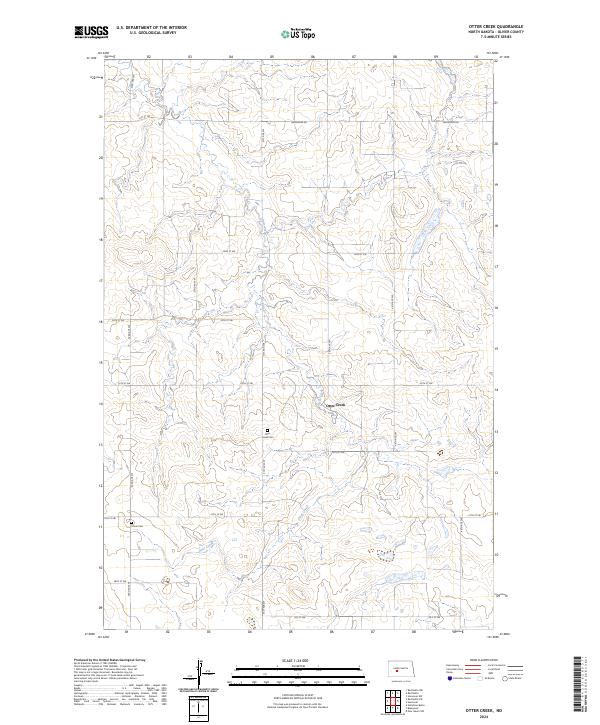
2024 Map of Otter Creek
USGS Topo · Published 2024About this map
Otter Creek meanders through this portion of Oliver County, cutting a winding path across the township lines of t141n r86w and t142n r86w. This rural landscape is defined by the Public Land Survey System grid, where local travel follows a network of section-line roads like 21st St SW and Hannover Rd. For genealogists and local historians, the map provides precise locations for family and community burial sites, including Otter Creek Cem located near the creek itself and Moos Cem further to the southwest. The terrain is characterized by subtle drainage patterns and small wetlands, illustrating the agricultural character of this North Dakota prairie region in the early twenty-first century.
Find a feature on this map
22 named features on this map. Tap any name to fly to it.
Don’t see what you’re looking for? This feature index may not catch every label — zoom into the map to look around manually.
Map Details
Editions of this 2024 Otter Creek Map
This is the sole edition of this map. No revisions or reprints were ever made.
Other maps of this area

1954 · Bismarck
USGS Topo · 1:250,000

1954 · McClusky
USGS Topo · 1:250,000

1958 · Bismarck
USGS Topo · 1:250,000

1958 · McClusky
USGS Topo · 1:250,000

1968 · Red Butte
USGS Topo · 1:24,000

1968 · Red Butte NW
USGS Topo · 1:24,000

1968 · Hannover NW
USGS Topo · 1:24,000

1970 · Bluegrass
USGS Topo · 1:24,000

1970 · New Salem NW
USGS Topo · 1:24,000

1970 · Hailstone Butte
USGS Topo · 1:24,000