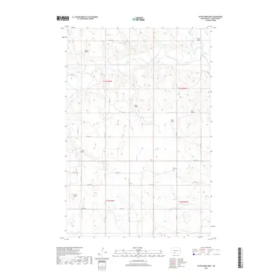
2018 Map of Otter Creek West
USGS Topo · Published 2018About this map
The Heart River meanders through the northern reaches of this Grant County landscape, defining a terrain shaped by deep erosional cuts and prominent rises. To the northeast, the Curlew Valley opens near the confluence of Big Muddy Cr, while the central and southern portions are dominated by an intricate network of coulees, including Snake Coulee, Griner Coulee, and Pony Coulee. These features reflect a classic North Dakota drainage pattern where seasonal watercourses have carved into the prairie over millennia.
Find a feature on this map
30 named features on this map. Tap any name to fly to it.
Don’t see what you’re looking for? This feature index may not catch every label — zoom into the map to look around manually.
Map Details
Editions of this 2018 Otter Creek West Map
This is the sole edition of this map. No revisions or reprints were ever made.
Other maps of this area
1954 · Bismarck
USGS Topo · 1:250,000
1958 · Bismarck
USGS Topo · 1:250,000
1980 · Otter Creek West
USGS Topo · 1:24,000
1980 · Green Ridge
USGS Topo · 1:24,000
1980 · Otter Creek East
USGS Topo · 1:24,000
1980 · Crown Butte Creek SE
USGS Topo · 1:24,000
1980 · Almont East
USGS Topo · 1:24,000
1980 · Lark
USGS Topo · 1:24,000
1980 · Dogtooth Buttes
USGS Topo · 1:24,000
1980 · Almont West
USGS Topo · 1:24,000