
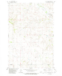
1980 Map of Otter Creek West
USGS Topo · Published 1980About this map
The Heart River meanders through the northern reaches of this Grant County landscape, joined by the waters of Big Muddy Creek near the Thompson Bridge. This 1980 survey illustrates a characteristic North Dakota terrain defined by high buttes and deeply incised drainage channels, such as Griner Coulee, Snake Coulee, and Pony Coulee. These landforms dictate the placement of rural infrastructure, with small-scale water management visible at Cat Coulee Dam. Evidence of early community life is found at the Otter Creek Cemetery, which sits above its namesake Otter Creek in the southeastern quadrant. Higher elevations are marked by distinctive landmarks like Point Butte and Devils Butte, providing significant navigational reference points across the rolling prairie. This map preserves the spatial relationship between these natural features and the scattered farmsteads of the era.
Find a feature on this map
16 named features on this map. Tap any name to fly to it.
Don’t see what you’re looking for? This feature index may not catch every label — zoom into the map to look around manually.
Map Details
Editions of this 1980 Otter Creek West Map
This is the sole edition of this map. No revisions or reprints were ever made.
Other maps of this area

1954 · Bismarck
USGS Topo · 1:250,000

1958 · Bismarck
USGS Topo · 1:250,000

1980 · Green Ridge
USGS Topo · 1:24,000

1980 · Otter Creek East
USGS Topo · 1:24,000

1980 · Crown Butte Creek SE
USGS Topo · 1:24,000

1980 · Almont East
USGS Topo · 1:24,000

1980 · Lark
USGS Topo · 1:24,000

1980 · Dogtooth Buttes
USGS Topo · 1:24,000
1980 · Almont West
USGS Topo · 1:24,000
1980 · Elgin
USGS Topo · 1:100,000