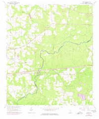
1961 Map of Ousley
USGS Topo · Published 1977About this map
The Withlacoochee River carves a winding path through this landscape along the border of Brooks and Lowndes counties, anchoring a region defined by its rural congregations and water resources. Small settlements like Ousley and Durden sit along the Seaboard Coast Line railroad, reflecting the importance of rail transport to these South Georgia communities in the mid-20th century.
Find a feature on this map
25 named features on this map. Tap any name to fly to it.
Don’t see what you’re looking for? This feature index may not catch every label — zoom into the map to look around manually.
Map Details
Editions of this 1961 Ousley Map
2 editions found

Other maps of this area

1954 · Valdosta
USGS Topo · 1:250,000

1956 · Clyattville
USGS Topo · 1:24,000

1956 · Nankin
USGS Topo · 1:24,000

1956 · Baden
USGS Topo · 1:24,000

1958 · Valdosta
USGS Topo · 1:250,000

1959 · Valdosta
USGS Topo · 1:250,000

1961 · Hahira East
USGS Topo · 1:24,000

1961 · Quitman
USGS Topo · 1:62,500

1961 · Valdosta
USGS Topo · 1:24,000

1961 · Hahira West
USGS Topo · 1:24,000