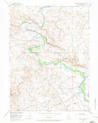
1955 Map of Overland Crossing
USGS Topo · Published 1973About this map
The North Platte River winds through this mid-century landscape in Carbon County, anchoring a region defined by historical cattle ranching and early western migration. The significance of the area is rooted in the Overland Trail, which cuts across the terrain toward the namesake Overland Crossing. This point on the river served as a critical passage for travelers, a fact reinforced by the proximity of numerous early 20th-century homesteads and livestock operations. Genealogists and local historians will find several family-named landmarks, including the Old Mc Keal Place, Old Johnson Place, and Old Frazier Place. The presence of a Coal Mine and Coal Mine Draw in the northwest corner highlights the localized extraction that supported early settlers, while the complex network of names like Mc Keal Meadows and Corpening Ranch illustrates the long-standing agricultural use of the river's fertile bottomlands.
Find a feature on this map
31 named features on this map. Tap any name to fly to it.
Don’t see what you’re looking for? This feature index may not catch every label — zoom into the map to look around manually.
Map Details
Editions of this 1955 Overland Crossing Map
3 editions found
Other maps of this area

1893 · Fort Steele
USGS Topo · 1:125,000

1932 · Savery
USGS Topo · 1:96,000

1939 · Saratoga
USGS Topo · 1:125,000

1940 · Savery
USGS Topo · 1:125,000

1954 · Rawlins
USGS Topo · 1:250,000

1955 · Overland
USGS Topo · 1:24,000

1955 · Overland Crossing
USGS Topo · 1:24,000

1955 · Meads
USGS Topo · 1:24,000

1955 · Savage Ranch
USGS Topo · 1:24,000

1956 · Bolten Ranch
USGS Topo · 1:62,500