1964 Map of Ovett SE
USGS Topo · Published 1982About this map
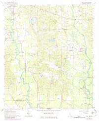
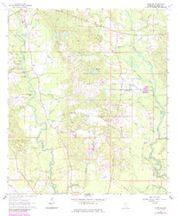
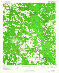
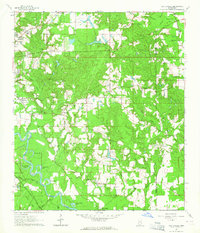
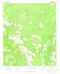
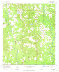
Runnelstown anchors the northern reaches of this landscape in Perry County, where the meandering waters of Tallahala Creek and Bogue Homo define the low-lying terrain. The map captures a transition in transportation, showing the Old RR Grade cutting through the northeast, a silent marker of former timber or industrial rail lines that once served the Piney Woods. Numerous small family or community burial grounds, such as McGilvary Cem and Couthey Cem, are scattered across the ridges, providing critical data points for genealogists. The area is dotted with local spiritual centers including Bethel Ch and Hickory Grove Ch, while the hydraulic character of the land is revealed through a network of small lakes like Izold Lake and Eddy Lake. This 1964 survey, with updates from the early 1980s, documents a rural Mississippi community defined by its watercourses and small-scale gravel extraction.
Find a feature on this map
50 named features on this map. Tap any name to fly to it.
Don’t see what you’re looking for? This feature index may not catch every label — zoom into the map to look around manually.
Map Details
Editions of this 1964 Ovett SE Map
3 editions found
Other maps of this area

1947 · Beaumont
USGS Topo · 1:62,500

1947 · New Augusta
USGS Topo · 1:62,500

1949 · Beaumont
USGS Topo · 1:62,500

1949 · New Augusta
USGS Topo · 1:62,500

1953 · Hattiesburg
USGS Topo · 1:250,000

1958 · Hattiesburg
USGS Topo · 1:250,000
1963 · Barrontown
USGS Topo · 1:24,000
1964 · Carterville
USGS Topo · 1:24,000
1964 · Rhodes
USGS Topo · 1:24,000
1964 · Ovett SE
USGS Topo · 1:24,000