1964 Map of Ovett SE
USGS Topo · Published 1985About this map
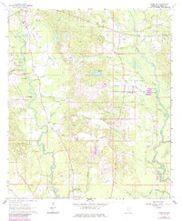
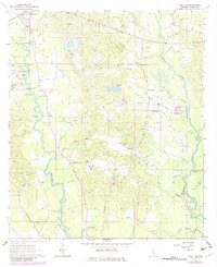
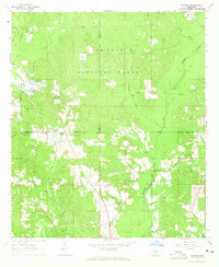
The lowlands of Perry County are defined here by the winding courses of Tallahala Creek and Bogue Homo, where numerous oxbow lakes like Eddy Lake and Izola Lake mark the shifting path of the water. The settlement at Runnelstown serves as a northern anchor, while the surrounding countryside is dotted with small family and community burial sites such as McGilvary Cem and Burch Cem. An Old RR Grade cutting through the northeast corner suggests the region's earlier dependence on rail transport for timber and local commerce.
Find a feature on this map
59 named features on this map. Tap any name to fly to it.
Don’t see what you’re looking for? This feature index may not catch every label — zoom into the map to look around manually.
Map Details
Editions of this 1964 Ovett SE Map
3 editions found
Other maps of this area

1947 · Beaumont
USGS Topo · 1:62,500

1947 · New Augusta
USGS Topo · 1:62,500

1949 · Beaumont
USGS Topo · 1:62,500

1949 · New Augusta
USGS Topo · 1:62,500

1953 · Hattiesburg
USGS Topo · 1:250,000

1958 · Hattiesburg
USGS Topo · 1:250,000
1963 · Barrontown
USGS Topo · 1:24,000
1964 · Carterville
USGS Topo · 1:24,000
1964 · Rhodes
USGS Topo · 1:24,000
1964 · Ovett SE
USGS Topo · 1:24,000