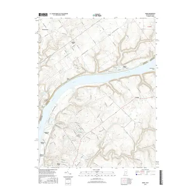
2016 Map of Owen
USGS Topo · Published 2016About this map
The Ohio River carves a deep valley between Clark County, Indiana, and Oldham County, Kentucky, serving as the central artery for this mid-2010s landscape. On the Indiana side, the terrain is marked by sharp bluffs and secluded spots like Rabbit Hollow and the narrow ridge of Devils Backbone. Small communities such as Owen, Vesta, and Rolling Hills sit atop the plateau above the river, while the recreational history of the area is anchored by Rose Island near the mouth of Fourteenmile Creek.
Find a feature on this map
110 named features on this map. Tap any name to fly to it.
Don’t see what you’re looking for? This feature index may not catch every label — zoom into the map to look around manually.
Map Details
Editions of this 2016 Owen Map
This is the sole edition of this map. No revisions or reprints were ever made.
Other maps of this area

1905 · Prospect
USGS Topo · 1:62,500

1912 · Prospect
USGS Topo · 1:62,500

1932 · La Grange
USGS Topo · 1:62,500

1937 · Jeffersonville
USGS Topo · 1:24,000

1937 · Charlestown
USGS Topo · 1:24,000

1938 · Owen
USGS Topo · 1:24,000

1939 · Bethlehem
USGS Topo · 1:24,000

1946 · Jeffersonville
USGS Topo · 1:24,000

1948 · Bethlehem
USGS Topo · 1:24,000

1948 · Owen
USGS Topo · 1:24,000