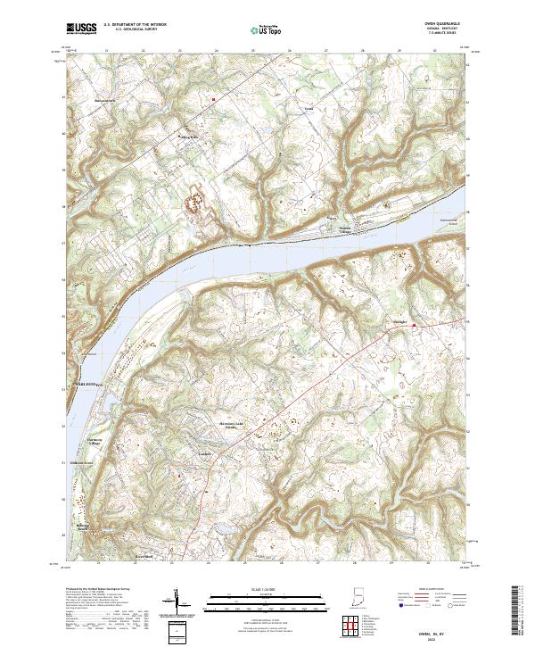
2022 Map of Owen
USGS Topo · Published 2022About this map
The Ohio River carves a deep valley through this borderland, separating the communities of Owen and Sunset Village on the northern bank from the Kentucky side near Skylight. The terrain is defined by dramatic river geography, including the prominent ridge of Devils Backbone and the landform of Rose Island tucked into a bend of the river. Inland from the banks, the landscape transitions from the river-level flats of Belknap Beach to the upland residential developments of Harmony Lake Estates and the established settlement of Goshen.
Find a feature on this map
115 named features on this map. Tap any name to fly to it.
Don’t see what you’re looking for? This feature index may not catch every label — zoom into the map to look around manually.
Map Details
Editions of this 2022 Owen Map
This is the sole edition of this map. No revisions or reprints were ever made.
Other maps of this area

1905 · Prospect
USGS Topo · 1:62,500

1912 · Prospect
USGS Topo · 1:62,500

1932 · La Grange
USGS Topo · 1:62,500

1937 · Jeffersonville
USGS Topo · 1:24,000

1937 · Charlestown
USGS Topo · 1:24,000

1938 · Owen
USGS Topo · 1:24,000

1939 · Bethlehem
USGS Topo · 1:24,000

1946 · Jeffersonville
USGS Topo · 1:24,000

1948 · Bethlehem
USGS Topo · 1:24,000

1948 · Owen
USGS Topo · 1:24,000