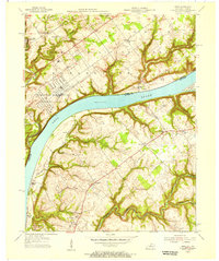
1954 Map of Owen
USGS Topo · Published 1956About this map
The Ohio River serves as the central artery for this mid-century landscape, carving a deep valley that separates Clark County, Indiana, from Oldham County, Kentucky. On the Indiana side, the massive U S Military Reservation (Indiana Arsenal) and Clark Military Reservation dominate the northern banks, reflecting the region's strategic importance during the post-war era. These military installations contrast with the small, rural settlements of Runyantown and Vesta, where local life centered around institutions like Salem Cem and Owen Creek Ch.
Find a feature on this map
32 named features on this map. Tap any name to fly to it.
Don’t see what you’re looking for? This feature index may not catch every label — zoom into the map to look around manually.
Map Details
Editions of this 1954 Owen Map
This is the sole edition of this map. No revisions or reprints were ever made.
Other maps of this area

1905 · Prospect
USGS Topo · 1:62,500

1912 · Prospect
USGS Topo · 1:62,500

1932 · La Grange
USGS Topo · 1:62,500

1937 · Jeffersonville
USGS Topo · 1:24,000

1937 · Charlestown
USGS Topo · 1:24,000

1938 · Owen
USGS Topo · 1:24,000

1939 · Bethlehem
USGS Topo · 1:24,000

1946 · Jeffersonville
USGS Topo · 1:24,000

1948 · Bethlehem
USGS Topo · 1:24,000

1948 · Owen
USGS Topo · 1:24,000