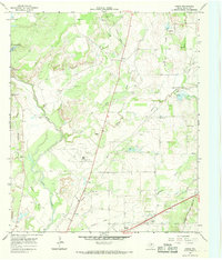
1966 Map of Owens
USGS Topo · Published 1968About this map
Pecan Bayou winds through this central Texas landscape, creating a complex drainage network alongside Elm Creek and Salt Creek. The map documents a period of significant infrastructure development, most notably the Brownwood Municipal Airport and a network of utilities including a siphon, aqueduct, and various pipelines. These technical features contrast with the rural character of smaller settlements like Owens and Early.
Find a feature on this map
33 named features on this map. Tap any name to fly to it.
Don’t see what you’re looking for? This feature index may not catch every label — zoom into the map to look around manually.
Map Details
Editions of this 1966 Owens Map
2 editions found
Other maps of this area

1887 · Coleman
USGS Topo · 1:125,000

1889 · Brownwood
USGS Topo · 1:125,000

1889 · Coleman
USGS Topo · 1:125,000

1894 · Brownwood
USGS Topo · 1:125,000

1924 · Coleman 1-a
USGS Topo · 1:48,000

1924 · Brownwood Reservoir Site
USGS Topo · 1:48,000

1925 · Brownwood 3-b
USGS Topo · 1:48,000

1927 · Grosvenor
USGS Topo · 1:62,500

1928 · Zephyr
USGS Topo · 1:62,500

1950 · Zephyr
USGS Topo · 1:62,500