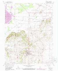
1959 Map of Owensville
USGS Topo · Published 1989About this map
Owensville serves as the central hub of this southwestern Indiana landscape, where the flat agricultural plains of the north meet the more varied terrain of Montgomery township to the south. The map documents a complex drainage network vital to local farming, including McCarty Ditch, Saunders Ditch, and Brown DITCH, which channel water toward the Black River. A significant historical marker, the Old Indian Treaty Boundary, cuts across the northeast corner, reflecting the early 19th-century surveying that defined land ownership in Gibson County. Rural life is anchored by small settlements like Lyles and Skelton, and numerous family and community burial grounds such as Sand Hill Cem, Mauck Cem, and Clark Cem. The transition from the lowlands of the Patoka river bottom to the elevated ground of Sand Hill illustrates the geographical diversity that influenced local road placement, such as Blair Road and Loefler Road.
Find a feature on this map
40 named features on this map. Tap any name to fly to it.
Don’t see what you’re looking for? This feature index may not catch every label — zoom into the map to look around manually.
Map Details
Editions of this 1959 Owensville Map
Other maps of this area

1901 · Princeton
USGS Topo · 1:62,500

1901 · Haubstadt
USGS Topo · 1:62,500

1903 · Haubstadt
USGS Topo · 1:62,500

1903 · New Harmony
USGS Topo · 1:62,500

1903 · Princeton
USGS Topo · 1:62,500

1903 · Patoka
USGS Topo · 1:125,000

1904 · Mount Carmel
USGS Topo · 1:62,500

1938 · New Harmony
USGS Topo · 1:62,500

1956 · Vincennes
USGS Topo · 1:250,000

1957 · Vincennes
USGS Topo · 1:250,000