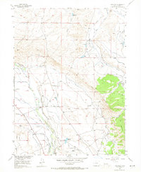
1955 Map of Owl Ridge
USGS Topo · Published 1965About this map
The Illinois River and its network of irrigation canals define this Jackson County landscape as it appeared in the mid-1950s. The region is characterized by a sophisticated system of water management, visible through named ditches like the Lowland Ditch, Pioneer Ditch, and Midland Ditch. These waterways support a series of family-named agricultural operations, including the Illinois Ranch and Overton Ranch, highlighting the importance of riparian rights in this high-altitude basin.
Find a feature on this map
35 named features on this map. Tap any name to fly to it.
Don’t see what you’re looking for? This feature index may not catch every label — zoom into the map to look around manually.
Map Details
Editions of this 1955 Owl Ridge Map
5 editions found
Other maps of this area

1954 · Craig
USGS Topo · 1:250,000

1955 · Gould
USGS Topo · 1:24,000

1955 · Owl Ridge
USGS Topo · 1:24,000

1955 · Gould NW
USGS Topo · 1:24,000

1955 · Walden
USGS Topo · 1:24,000

1955 · Mac Farlane Reservoir
USGS Topo · 1:24,000

1955 · Walden
USGS Topo · 1:62,500

1956 · Johnny Moore Mountain
USGS Topo · 1:24,000

1956 · Jack Creek Ranch
USGS Topo · 1:24,000

1956 · Buffalo Peak
USGS Topo · 1:24,000