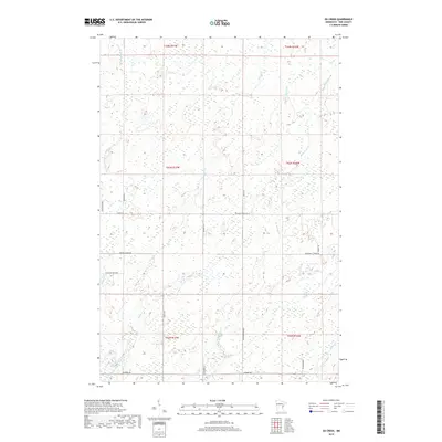
2019 Map of Ox Creek
USGS Topo · Published 2019About this map
The Lower Tamarack River winds through the northwestern reaches of this Pine County landscape, defining a terrain shaped by the intricate hydrology of Keene Cr and Little McDermott Cr. The settlement pattern is characterized by a sparse grid of rural roads, where family-named and descriptive routes like Pete Anderson Rd and School House Dr hint at the local history of land use and community hubs. In the south, the waters of Ox Cr and Little Ox Cr converge near Duxbury Rd, illustrating the riverine network that has long influenced navigation and access in Park Township. The eastern portion is dominated by the flow of McDermott Cr and Squib Cr, while the Munger Trl provides a modern longitudinal corridor through this complex environment of wetlands and small tributaries.
Find a feature on this map
29 named features on this map. Tap any name to fly to it.
Don’t see what you’re looking for? This feature index may not catch every label — zoom into the map to look around manually.
Map Details
Editions of this 2019 Ox Creek Map
This is the sole edition of this map. No revisions or reprints were ever made.
Other maps of this area

1949 · Danbury
USGS Topo · 1:48,000

1949 · Holyoke
USGS Topo · 1:48,000

1953 · Duluth
USGS Topo · 1:250,000

1958 · Duluth
USGS Topo · 1:250,000

1962 · Holyoke
USGS Topo · 1:62,500

1962 · Bruno
USGS Topo · 1:62,500

1962 · Cloverdale
USGS Topo · 1:62,500

1962 · Danbury
USGS Topo · 1:62,500

1980 · Sandstone
USGS Topo · 1:100,000
1981 · Kerrick
USGS Topo · 1:24,000