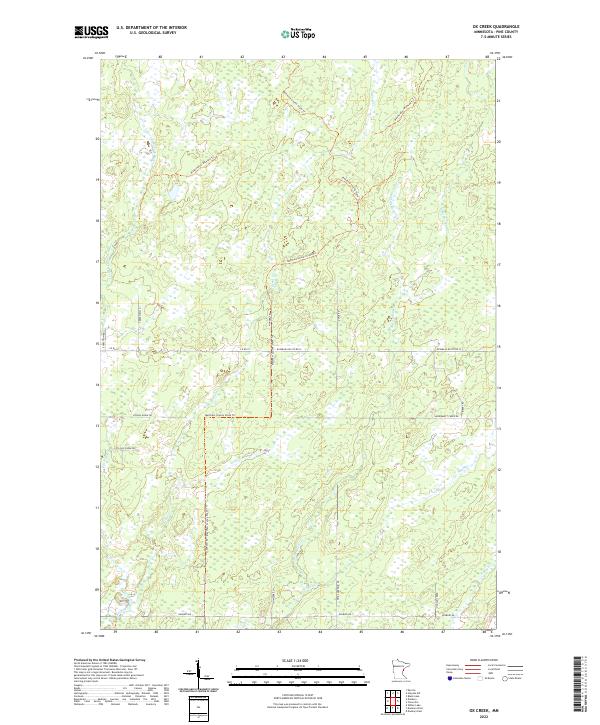
2022 Map of Ox Creek
USGS Topo · Published 2022About this map
The Lower Tamarack River and its numerous tributaries define the drainage of this Pine County landscape, where water and trails intersect in a dense network of creeks. Significant corridors like the Matthew Lourey State Trl and the Washington/Ramsey Trl traverse the terrain, reflecting the modern recreational use of the region's expansive wetlands. This 2022 survey captures a transition point between the higher ground of the northern townships and the lower drainage basins to the south.
Find a feature on this map
31 named features on this map. Tap any name to fly to it.
Don’t see what you’re looking for? This feature index may not catch every label — zoom into the map to look around manually.
Map Details
Editions of this 2022 Ox Creek Map
This is the sole edition of this map. No revisions or reprints were ever made.
Other maps of this area

1949 · Danbury
USGS Topo · 1:48,000

1949 · Holyoke
USGS Topo · 1:48,000

1953 · Duluth
USGS Topo · 1:250,000

1958 · Duluth
USGS Topo · 1:250,000

1962 · Holyoke
USGS Topo · 1:62,500

1962 · Bruno
USGS Topo · 1:62,500

1962 · Cloverdale
USGS Topo · 1:62,500

1962 · Danbury
USGS Topo · 1:62,500

1980 · Sandstone
USGS Topo · 1:100,000
1981 · Kerrick
USGS Topo · 1:24,000