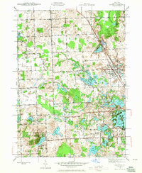
1943 Map of Oxford
USGS Topo · Published 1966About this map
The village of Oxford sits at a critical junction of transportation and topography in northern Oakland County during the early 1940s. The Michigan Central RR and Michigan State Highway No 24 anchor the eastern corridor, where the town developed as a hub for the surrounding agricultural and lakefront communities. To the west, the landscape is defined by an intricate network of glacial kettle lakes, including Stony Lake, Seymour Lake, and Walters Lake, which shaped the early recreational and residential patterns of the area.
Find a feature on this map
92 named features on this map. Tap any name to fly to it.
Don’t see what you’re looking for? This feature index may not catch every label — zoom into the map to look around manually.
Map Details
Editions of this 1943 Oxford Map
2 editions found
Other maps of this area

1907 · Pontiac
USGS Topo · 1:62,500

1908 · Rochester
USGS Topo · 1:62,500

1936 · Clarkston
USGS Topo · 1:31,680

1936 · Rochester
USGS Topo · 1:31,680

1936 · Pontiac North
USGS Topo · 1:31,680

1943 · Clarkston
USGS Topo · 1:24,000

1943 · Pontiac North
USGS Topo · 1:24,000

1943 · Ortonville
USGS Topo · 1:24,000

1943 · Lake Orion
USGS Topo · 1:24,000

1943 · Oxford
USGS Topo · 1:24,000
Featured Places
- Orion Charter Township, MI
- Independence Charter Township, MI
- Oxford Charter Township, MI
- Oxford, MI
- Lake Orion, MI