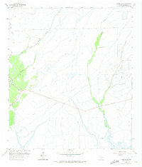
1961 Map of Oyster Bayou
USGS Topo · Published 1974About this map
Oyster Bayou and its winding East Fork define the hydrological character of this coastal Texas landscape, where the marshy terrain of Chambers County met the mid-century petroleum industry. The 1961 survey documents a network of infrastructure including the Oyster Bayou Oil Field, numerous Oil Wells, and several Disposal Wells, alongside a series of pumping stations and pipelines that crisscross the low-lying prairie.
Find a feature on this map
17 named features on this map. Tap any name to fly to it.
Don’t see what you’re looking for? This feature index may not catch every label — zoom into the map to look around manually.
Map Details
Editions of this 1961 Oyster Bayou Map
3 editions found
Other maps of this area

1931 · High Island
USGS Topo · 1:24,000

1931 · Frozen Point
USGS Topo · 1:24,000

1933 · Frozen Point
USGS Topo · 1:31,680

1933 · Whites Lake
USGS Topo · 1:31,680

1942 · Anahuac
USGS Topo · 1:24,000

1943 · High Island
USGS Topo · 1:31,680

1943 · Frozen Point
USGS Topo · 1:24,000
1943 · Lake Stephenson
USGS Topo · 1:24,000

1943 · Sea Breeze
USGS Topo · 1:24,000

1943 · Stowell
USGS Topo · 1:24,000