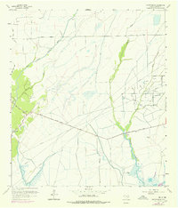
1961 Map of Oyster Bayou
USGS Topo · Published 1978About this map
Oyster Bayou and its winding tributaries dominate this coastal Texas landscape, where the petroleum industry and ranching geography converge. The Oyster Bayou Oil Field is a central industrial feature, marked by numerous Oil Wells, disposal sites, and Pumping Stations that define the local economy during the mid-20th century. Transportation across these wetlands relies on established routes such as Whites Ranch Road and Smith Point Road, which intersect near the historic Jackson Cem. Settlement is sparse, with the small community of Pine Island located along the western edge of the quadrangle. The map reveals a complex network of waterways, including Double Bayou, Bad East Gully, and Chimney Bayou, reflecting the intricate drainage patterns of the low-lying Chambers County terrain.
Find a feature on this map
17 named features on this map. Tap any name to fly to it.
Don’t see what you’re looking for? This feature index may not catch every label — zoom into the map to look around manually.
Map Details
Editions of this 1961 Oyster Bayou Map
3 editions found
Other maps of this area

1931 · High Island
USGS Topo · 1:24,000

1931 · Frozen Point
USGS Topo · 1:24,000

1933 · Frozen Point
USGS Topo · 1:31,680

1933 · Whites Lake
USGS Topo · 1:31,680

1942 · Anahuac
USGS Topo · 1:24,000

1943 · High Island
USGS Topo · 1:31,680

1943 · Frozen Point
USGS Topo · 1:24,000
1943 · Lake Stephenson
USGS Topo · 1:24,000

1943 · Sea Breeze
USGS Topo · 1:24,000

1943 · Stowell
USGS Topo · 1:24,000