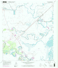
1963 Map of Oyster Creek
USGS Topo · Published 1977About this map
The coastal prairie of Brazoria County is defined by a dense network of meandering waterways, where Bastrop Bayou and Austin Bayou wind through low-lying terrain. This 1963 survey, photorevised in 1974, reveals a landscape of industrial extraction and rural settlement, centered on the Stratton Ridge Oil Field. Significant salt, oil, and gas development is evident throughout the region, with numerous Salt Wells and Gas Wells dotting the map near the Missouri Pacific railroad line. Local social geography is anchored by small community centers like Mims and Oyster Creek, and traditional landmarks such as Evergreen Ch and the Hoskins Cem. The southern reach toward Salt Lake illustrates the complex hydrology of the Gulf Coast, where brackish sloughs like Big Slough and Little Slough intersect with family-named settlements such as Stubblefield and Bastrop Beach.
Find a feature on this map
35 named features on this map. Tap any name to fly to it.
Don’t see what you’re looking for? This feature index may not catch every label — zoom into the map to look around manually.
Map Details
Editions of this 1963 Oyster Creek Map
Other maps of this area

1943 · Oyster Creek
USGS Topo · 1:31,680

1943 · Jones Creek
USGS Topo · 1:31,680

1943 · Danbury
USGS Topo · 1:31,680

1943 · Freeport
USGS Topo · 1:31,680

1943 · Angleton
USGS Topo · 1:24,000

1943 · Christmas Point
USGS Topo · 1:24,000

1943 · Chocolate Bay
USGS Topo · 1:24,000

1943 · Snipe
USGS Topo · 1:31,680

1950 · Houston
USGS Topo · 1:250,000

1951 · Bay City
USGS Topo · 1:250,000