
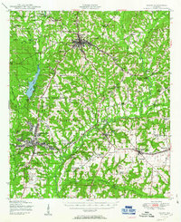
1950 Map of Ozark
USGS Topo · Published 1950About this map
Ozark serves as the focal point for this mid-century portrait of Dale County, appearing at a time of significant military expansion. The sprawling Camp Rucker installation dominates the western and southern reaches of the map, featuring the Ozark Airfield and numerous administrative and training zones. In contrast to the rising military footprint, the landscape remains dotted with traditional rural markers, from the Marley Millpond and Faulks Mill to a dense network of local houses of worship such as Claybank Church and Salem Cemetery Church.
Find a feature on this map
64 named features on this map. Tap any name to fly to it.
Don’t see what you’re looking for? This feature index may not catch every label — zoom into the map to look around manually.
Map Details
Editions of this 1950 Ozark Map
2 editions found
Other maps of this area

1942 · Enterprise
USGS Topo · 1:125,000

1948 · Ozark
USGS Topo · 1:62,500

1948 · Brundidge
USGS Topo · 1:62,500

1950 · Enterprise
USGS Topo · 1:62,500

1950 · Brundidge
USGS Topo · 1:62,500

1953 · Dothan
USGS Topo · 1:250,000

1954 · Dothan
USGS Topo · 1:250,000

1955 · Dothan
USGS Topo · 1:250,000

1957 · Malvern
USGS Topo · 1:24,000

1957 · Geneva
USGS Topo · 1:62,500