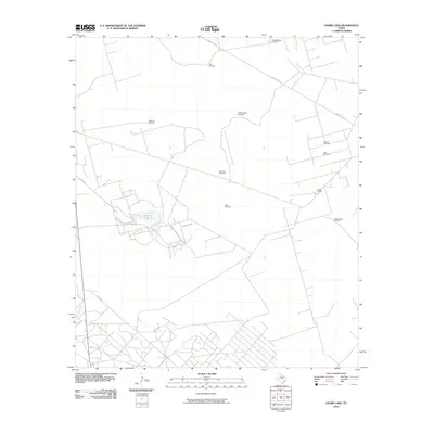
2010 Map of Ozark Lake
USGS Topo · Published 2010About this map
Ozark Lake serves as the central focal point of this arid Crane County landscape, surrounded by an intricate network of local ranching infrastructure. The area is defined by its reliance on groundwater, illustrated by a dense concentration of named landmarks such as the NorthWinters Windmill, Sam Windmill, and Gyp Flats Windmill. These features, alongside Estes Ranch, reveal the enduring pastoral character of this section of West Texas during the early 21st century.
Find a feature on this map
16 named features on this map. Tap any name to fly to it.
Don’t see what you’re looking for? This feature index may not catch every label — zoom into the map to look around manually.
Map Details
Editions of this 2010 Ozark Lake Map
This is the sole edition of this map. No revisions or reprints were ever made.
Other maps of this area

1954 · Pecos
USGS Topo · 1:250,000

1957 · Pecos
USGS Topo · 1:250,000

1964 · Penwell SW
USGS Topo · 1:24,000

1968 · Monahans SE
USGS Topo · 1:24,000

1969 · Ozark Lake
USGS Topo · 1:24,000

1969 · Grandfalls
USGS Topo · 1:24,000

1969 · Monahans
USGS Topo · 1:24,000

1969 · 7 L Ranch
USGS Topo · 1:24,000
1974 · Imperial NW
USGS Topo · 1:24,000
1974 · Imperial
USGS Topo · 1:24,000