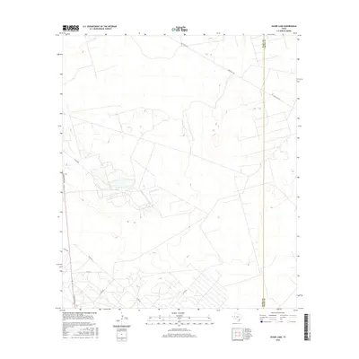
2016 Map of Ozark Lake
USGS Topo · Published 2016About this map
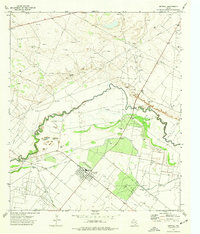
Ozark Lake serves as a central focal point in this West Texas landscape, positioned near the western edge of the quadrangle. The terrain is marked by the irregular boundary between Ward and Crane counties, illustrating the rural transition between these two administrative zones. The area is defined by a network of secondary routes and oil-field access roads, including Ranch Rd 1233 and S Stockton Ave. The dense grid of unnamed tracks and local designations like Co Rd 2085 and Co Rd 241 reflects the industrial footprint of petroleum extraction in the Permian Basin during the early twenty-first century. This survey documents the specific drainage patterns and land-use infrastructure characteristic of the high desert plains before further modern development.
Find a feature on this map
10 named features on this map. Tap any name to fly to it.
Don’t see what you’re looking for? This feature index may not catch every label — zoom into the map to look around manually.
Map Details
Editions of this 2016 Ozark Lake Map
This is the sole edition of this map. No revisions or reprints were ever made.
Other maps of this area

1954 · Pecos
USGS Topo · 1:250,000

1957 · Pecos
USGS Topo · 1:250,000
1964 · Penwell SW
USGS Topo · 1:24,000
1968 · Monahans SE
USGS Topo · 1:24,000
1969 · Ozark Lake
USGS Topo · 1:24,000
1969 · Grandfalls
USGS Topo · 1:24,000
1969 · Monahans
USGS Topo · 1:24,000
1969 · 7 L Ranch
USGS Topo · 1:24,000
1974 · Imperial NW
USGS Topo · 1:24,000
1974 · Imperial
USGS Topo · 1:24,000