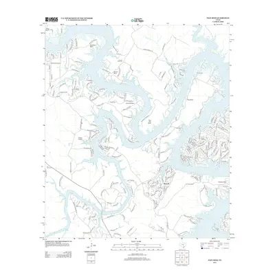
2012 Map of Pace Bend
USGS Topo · Published 2012About this map
The Pedernales River snakes through the Texas Hill Country, feeding into the expansive Lake Travis near the established community of Briarcliff. This 2012 landscape is defined by the dramatic winding bends of the river, including Muleshoe Bend, Gloster Bend, and Turkey Bend, which create deep peninsulas and sheltered coves. The map reflects a modern residential and recreational geography, with dense road networks serving shoreline developments and local landmarks such as Camp Texlake and the Spicewood Airport.
Find a feature on this map
215 named features on this map. Tap any name to fly to it.
Don’t see what you’re looking for? This feature index may not catch every label — zoom into the map to look around manually.
Map Details
Editions of this 2012 Pace Bend Map
This is the sole edition of this map. No revisions or reprints were ever made.
Other maps of this area

1887 · Blanco
USGS Topo · 1:125,000

1887 · Burnet
USGS Topo · 1:125,000

1893 · Georgetown
USGS Topo · 1:125,000

1893 · Burnet
USGS Topo · 1:125,000

1894 · Blanco
USGS Topo · 1:125,000

1896 · Austin
USGS Topo · 1:125,000

1897 · Austin
USGS Topo · 1:125,000

1903 · Burnet
USGS Topo · 1:125,000

1909 · Burnet
USGS Topo · 1:125,000

1910 · Austin
USGS Topo · 1:125,000