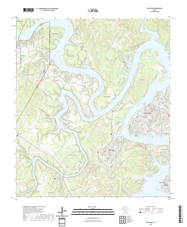
2022 Map of Pace Bend
USGS Topo · Published 2022About this map
The Colorado River and Lake Travis define the winding, peninsula-heavy landscape of this region where Travis and Burnet counties meet. Modern residential developments like Lago Vista, Briarcliff, and Point Venture dominate the shorelines, yet the map preserves numerous small family burial grounds that hint at the area's rural ancestry. Genealogical sites such as Haynie Flat Cem, Singleton Family Cem, and Maxey Cem are interspersed among the contemporary street grids. The topography is shaped by dramatic river bends, including the namesake Pace Bend and the nearby Muleshoe Bend, creating a complex network of inlets and hollows. Transport in the area is a mix of aviation at Spicewood Airport and a dense web of local roads serving the lakeside communities, while the Pedernales River flows in from the southwest to join the primary waterway.
Find a feature on this map
207 named features on this map. Tap any name to fly to it.
Don’t see what you’re looking for? This feature index may not catch every label — zoom into the map to look around manually.
Map Details
Editions of this 2022 Pace Bend Map
This is the sole edition of this map. No revisions or reprints were ever made.
Other maps of this area

1887 · Blanco
USGS Topo · 1:125,000

1887 · Burnet
USGS Topo · 1:125,000

1893 · Georgetown
USGS Topo · 1:125,000

1893 · Burnet
USGS Topo · 1:125,000

1894 · Blanco
USGS Topo · 1:125,000

1896 · Austin
USGS Topo · 1:125,000

1897 · Austin
USGS Topo · 1:125,000

1903 · Burnet
USGS Topo · 1:125,000

1909 · Burnet
USGS Topo · 1:125,000

1910 · Austin
USGS Topo · 1:125,000