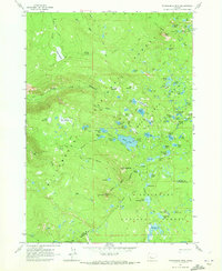
1963 Map of Packsaddle Mtn
USGS Topo · Published 1973About this map
High-elevation wetlands and volcanic peaks define this 1963 survey of the Cascade crest, where the boundary between Willamette National Forest and Deschutes National Forest follows the jagged ridgelines. The landscape is a complex network of glacial basins and meadows, including Shroy Meadows and the expansive Beaver Marsh. Large water bodies like Mink Lake and Petes Lake sit alongside smaller, evocatively named features such as Questionmark Lake and Nightshade Lakes.
Find a feature on this map
87 named features on this map. Tap any name to fly to it.
Don’t see what you’re looking for? This feature index may not catch every label — zoom into the map to look around manually.
Map Details
Editions of this 1963 Packsaddle Mtn Map
4 editions found
Other maps of this area

1925 · Waldo Lake
USGS Topo · 1:125,000

1929 · Three Sisters
USGS Topo · 1:125,000

1930 · Maiden Peak
USGS Topo · 1:125,000

1932 · Three Sisters
USGS Topo · 1:125,000

1934 · Maiden Peak
USGS Topo · 1:125,000

1934 · Mc Kenzie Bridge
USGS Topo · 1:96,000

1940 · Mc Kenzie Bridge
USGS Topo · 1:125,000

1953 · Salem
USGS Topo · 1:250,000

1954 · Salem
USGS Topo · 1:250,000

1955 · Chucksney Mtn
USGS Topo · 1:62,500