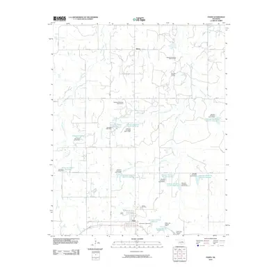
2010 Map of Paden
USGS Topo · Published 2010About this map
Paden serves as the primary settlement on this Okfuskee County landscape, where the grid of rural roads meets a series of water management projects. The area is characterized by an extensive system of reservoirs and dams, such as the Okfuskee Tributaries Site H-1 Reservoir and Oknoname 107014 Reservoir, which punctuate the drainage basins of Pettiquah Creek and Hilliby Creek. These man-made features highlight the mid-century and later efforts to control local waterways for agriculture and municipal use, including Paden Lake Number 1 and Paden Lake Number 2 just south of the town center. Local history is grounded at the Oakdale Cemetery north of town and the presence of the Southeast Laffoon Oil Field, indicating the region's historical reliance on both petroleum extraction and managed water resources.
Find a feature on this map
55 named features on this map. Tap any name to fly to it.
Don’t see what you’re looking for? This feature index may not catch every label — zoom into the map to look around manually.
Map Details
Editions of this 2010 Paden Map
This is the sole edition of this map. No revisions or reprints were ever made.
Other maps of this area

1896 · Seminole and Prague
USGS Topo · 1:125,000

1900 · Wewoka
USGS Topo · 1:125,000

1901 · Nuyaka
USGS Topo · 1:125,000

1929 · Stroud
USGS Topo · 1:62,500

1932 · Stroud
USGS Topo · 1:62,500

1954 · Oklahoma City
USGS Topo · 1:250,000

1957 · Oklahoma City
USGS Topo · 1:250,000

1963 · Oklahoma City
USGS Topo · 1:250,000

1967 · Prague NE
USGS Topo · 1:24,000

1967 · Boley
USGS Topo · 1:24,000