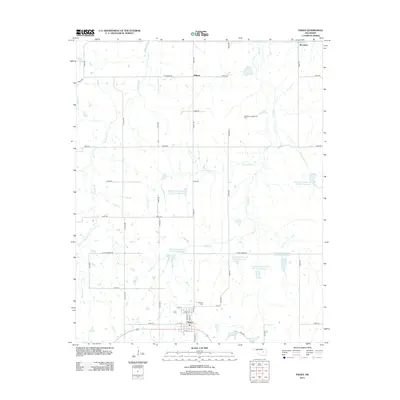
2012 Map of Paden
USGS Topo · Published 2012About this map
The town of Paden serves as the central hub of this Okfuskee County landscape, where the grid of local section roads meets a complex network of tributaries and managed water resources. North of the town center, the Southeast Laffoon Oil Field indicates the region's historical and ongoing connection to the petroleum industry. The landscape is defined by a series of engineered water bodies, including Okfuskee Tributaries Site H-3 Reservoir and Okfuskee Tributaries Site H-7 Reservoir, which sit alongside natural drainages like Hilliby Cr and Pettiquah Cr. These reservoirs suggest a history of local water management and flood control in the rural areas surrounding smaller settlements like Midway and Micawber. Genealogists and local historians can locate the Oakdale Cem north of town and trace the paths of historic routes such as W John Deere Rd.
Find a feature on this map
47 named features on this map. Tap any name to fly to it.
Don’t see what you’re looking for? This feature index may not catch every label — zoom into the map to look around manually.
Map Details
Editions of this 2012 Paden Map
This is the sole edition of this map. No revisions or reprints were ever made.
Other maps of this area

1896 · Seminole and Prague
USGS Topo · 1:125,000

1900 · Wewoka
USGS Topo · 1:125,000

1901 · Nuyaka
USGS Topo · 1:125,000

1929 · Stroud
USGS Topo · 1:62,500

1932 · Stroud
USGS Topo · 1:62,500

1954 · Oklahoma City
USGS Topo · 1:250,000

1957 · Oklahoma City
USGS Topo · 1:250,000

1963 · Oklahoma City
USGS Topo · 1:250,000

1967 · Prague NE
USGS Topo · 1:24,000

1967 · Boley
USGS Topo · 1:24,000