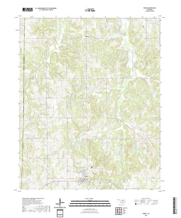
2022 Map of Paden
USGS Topo · Published 2022About this map
Paden stands at the center of this rural landscape in western Okfuskee County, where the terrain is defined by an extensive network of water management and local drainage. The town's grid is anchored by streets such as W 7th St and 3rd St, while the surrounding countryside is dotted with a series of numbered reservoirs, including Okfuskee Tributaries Site H-5 Reservoir and Paden Lake Number Two. These man-made features are integrated with natural waterways like Hilliby Cr and Pettiquah Creek. Historically significant markers for genealogists include the Oakdale Cem located just north of the main settlement. Further north, the small community of Midway sits along the road network near the border with Lincoln County, illustrating the distributed nature of early Oklahoma ranching and farming settlements.
Find a feature on this map
40 named features on this map. Tap any name to fly to it.
Don’t see what you’re looking for? This feature index may not catch every label — zoom into the map to look around manually.
Map Details
Editions of this 2022 Paden Map
This is the sole edition of this map. No revisions or reprints were ever made.
Other maps of this area

1896 · Seminole and Prague
USGS Topo · 1:125,000

1900 · Wewoka
USGS Topo · 1:125,000

1901 · Nuyaka
USGS Topo · 1:125,000

1929 · Stroud
USGS Topo · 1:62,500

1932 · Stroud
USGS Topo · 1:62,500

1954 · Oklahoma City
USGS Topo · 1:250,000

1957 · Oklahoma City
USGS Topo · 1:250,000

1963 · Oklahoma City
USGS Topo · 1:250,000

1967 · Prague NE
USGS Topo · 1:24,000

1967 · Boley
USGS Topo · 1:24,000