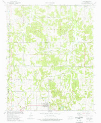
1974 Map of Paden
USGS Topo · Published 1977About this map
The town of Paden and the surrounding Okfuskee County landscape reflect an era of transition in the mid-1970s, where traditional rural life met the infrastructure of the energy industry. The map captures the presence of an active Oil Field and several pipelines cutting across the terrain, notably near Midway and the northern reaches of Hilliby Creek. These industrial markings contrast with established community landmarks like Micawber Ch and the remote Barnett Mission Ch.
Find a feature on this map
17 named features on this map. Tap any name to fly to it.
Don’t see what you’re looking for? This feature index may not catch every label — zoom into the map to look around manually.
Map Details
Editions of this 1974 Paden Map
This is the sole edition of this map. No revisions or reprints were ever made.
Other maps of this area

1896 · Seminole and Prague
USGS Topo · 1:125,000

1900 · Wewoka
USGS Topo · 1:125,000

1901 · Nuyaka
USGS Topo · 1:125,000

1929 · Stroud
USGS Topo · 1:62,500

1932 · Stroud
USGS Topo · 1:62,500

1954 · Oklahoma City
USGS Topo · 1:250,000

1957 · Oklahoma City
USGS Topo · 1:250,000

1963 · Oklahoma City
USGS Topo · 1:250,000

1967 · Prague NE
USGS Topo · 1:24,000

1967 · Boley
USGS Topo · 1:24,000