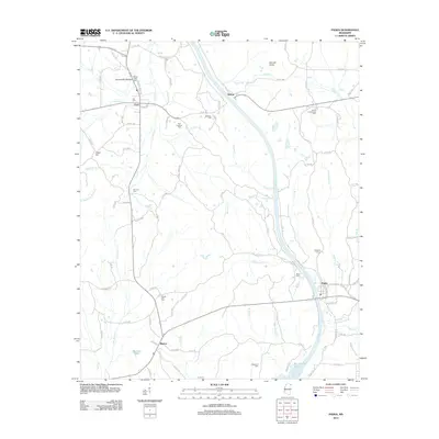
2012 Map of Paden
USGS Topo · Published 2012About this map
Paden and the surrounding rural communities of Tishomingo County are defined by a complex network of waterways feeding into Bay Springs Lake and the Tennessee-Tombigbee Waterway system. The landscape transition is evident where Mackeys Cr and Black Br converge near the southern edge of the sheet. For genealogists and local historians, this survey is particularly valuable for its density of community landmarks, including New Lebanon Cem, Forked Oak Cem, and South Crossroads Cem. The geography is marked by distinctive elevations such as Barnett Knob and Odom Hill, while the Natchez Trce and historical routes like Mount Gilead Rd provide a clear view of the area's transportation development. Small settlements like Cairo, Holcut, and Burton represent the enduring rural character of this northern Mississippi region.
Find a feature on this map
43 named features on this map. Tap any name to fly to it.
Don’t see what you’re looking for? This feature index may not catch every label — zoom into the map to look around manually.
Map Details
Editions of this 2012 Paden Map
This is the sole edition of this map. No revisions or reprints were ever made.
Other maps of this area

1911 · Iuka
USGS Topo · 1:48,000

1914 · Iuka
USGS Topo · 1:62,500

1935 · Holcut
USGS Topo · 1:24,000

1935 · Iuka
USGS Topo · 1:24,000

1935 · Leedy
USGS Topo · 1:24,000

1935 · Glens
USGS Topo · 1:24,000

1936 · Belmont
USGS Topo · 1:24,000

1936 · Tishomingo
USGS Topo · 1:24,000

1950 · Paden
USGS Topo · 1:24,000
1950 · Burnsville
USGS Topo · 1:24,000