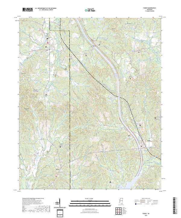
2024 Map of Paden
USGS Topo · Published 2024About this map
Paden and the surrounding borderlands of Tishomingo and Prentiss counties are defined by the massive infrastructure of the Tennessee Tombigbee Waterway, which carves a path through the rolling terrain toward Bay Springs Lake. This modern landscape preserves fragments of older rural life, where small settlements like Cairo, Holcut, and Burton serve as anchors for a network of family-named landmarks and country crossroads. The Tennessee Valley Divide snakes through the western portion of the map, separating the drainage of Yellow Creek from the southern-flowing waters of Mackeys Creek.
Find a feature on this map
107 named features on this map. Tap any name to fly to it.
Don’t see what you’re looking for? This feature index may not catch every label — zoom into the map to look around manually.
Map Details
Editions of this 2024 Paden Map
This is the sole edition of this map. No revisions or reprints were ever made.
Other maps of this area

1911 · Iuka
USGS Topo · 1:48,000

1914 · Iuka
USGS Topo · 1:62,500

1935 · Holcut
USGS Topo · 1:24,000

1935 · Iuka
USGS Topo · 1:24,000

1935 · Leedy
USGS Topo · 1:24,000

1935 · Glens
USGS Topo · 1:24,000

1936 · Belmont
USGS Topo · 1:24,000

1936 · Tishomingo
USGS Topo · 1:24,000

1950 · Paden
USGS Topo · 1:24,000
1950 · Burnsville
USGS Topo · 1:24,000