
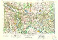
1949 Map of Paducah
USGS Topo · Published 1949About this map
The confluence of the Ohio River and the Mississippi River at Cairo forms the strategic center of this mid-century survey, where Illinois, Kentucky, and Missouri meet. This is a landscape defined by its major waterways, as the Tennessee River and Cumberland River join the Ohio near Paducah and Smithland. To the north, the industrial character of Southern Illinois is evident in the cluster of mining and rail towns like Herrin, Marion, and West Frankfort, alongside the newer waters of Crab Orchard Lake.
Find a feature on this map
159 named features on this map. Tap any name to fly to it.
Don’t see what you’re looking for? This feature index may not catch every label — zoom into the map to look around manually.
Map Details
Editions of this 1949 Paducah Map
2 editions found
Other maps of this area

1903 · New Harmony
USGS Topo · 1:62,500

1903 · Patoka
USGS Topo · 1:125,000

1905 · Eldorado
USGS Topo · 1:62,500

1905 · New Haven
USGS Topo · 1:62,500

1906 · New Haven
USGS Topo · 1:62,500

1906 · Eldorado
USGS Topo · 1:62,500

1907 · Morganfield
USGS Topo · 1:62,500

1907 · Weingarten
USGS Topo · 1:62,500

1908 · Galatia
USGS Topo · 1:62,500

1908 · Princeton
USGS Topo · 1:62,500