
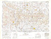
1954 Map of Paducah
USGS Topo · Published 1954About this map
The confluence of the Ohio River and Mississippi River at Cairo anchors this mid-century regional survey. The landscape is defined by the convergence of major waterways, including the Wabash River, Tennessee River, and Cumberland River, which facilitated a complex network of river commerce and rail transport. Industrial centers like Marion, Herrin, and Harrisburg are connected by a dense web of rail lines, such as the Illinois Central Railroad and the Louisville & Nashville Railroad, illustrating the coal and manufacturing economy of Southern Illinois and Western Kentucky. Uplands like the Shawneetown Hills and Wildcat Hills rise above the river bottoms, while managed waters including Crab Orchard Lake and the Kentucky Reservoir show the era's significant hydraulic engineering projects. Smaller river towns such as Cave in Rock and Rosiclare provide specific points of interest for local history researchers.
Find a feature on this map
275 named features on this map. Tap any name to fly to it.
Don’t see what you’re looking for? This feature index may not catch every label — zoom into the map to look around manually.
Map Details
Editions of this 1954 Paducah Map
2 editions found
Other maps of this area

1903 · New Harmony
USGS Topo · 1:62,500

1903 · Patoka
USGS Topo · 1:125,000

1905 · Eldorado
USGS Topo · 1:62,500

1905 · New Haven
USGS Topo · 1:62,500

1906 · New Haven
USGS Topo · 1:62,500

1906 · Eldorado
USGS Topo · 1:62,500

1907 · Morganfield
USGS Topo · 1:62,500

1907 · Weingarten
USGS Topo · 1:62,500

1908 · Galatia
USGS Topo · 1:62,500

1908 · Princeton
USGS Topo · 1:62,500