
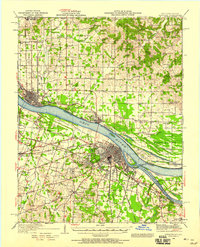
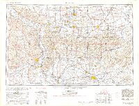
1964 Map of Paducah
USGS Topo · Published 1964This historical map portrays the area of Paducah in 1964, primarily covering McCracken County as well as portions of Illinois, Indiana, and Missouri. Featuring a scale of 1:250000, this map provides a highly detailed snapshot of the terrain, roads, buildings, counties, and historical landmarks in the Paducah region at the time. Published in 1964, it is one of 2 known editions of this map due to revisions or reprints.
Find a feature on this map
96 named features on this map. Tap any name to fly to it.
Don’t see what you’re looking for? This feature index may not catch every label — zoom into the map to look around manually.
Map Details
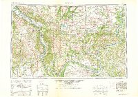
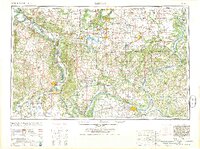
Editions of this 1964 Paducah Map
2 editions found
Historical Maps of Wolf Creek Through Time
12 maps found

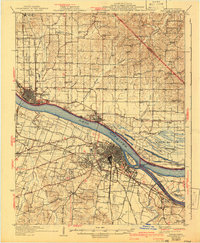
1926 Paducah
McCracken County, KY
1929 Paducah
McCracken County, KY
1936 Paducah
McCracken County, KY
1940 Paducah
McCracken County, KY
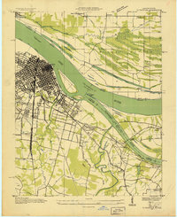
1949 Paducah
McCracken County, KY

1950 Paducah
McCracken County, KY
1954 Paducah
McCracken County, KY
1961 Paducah
McCracken County, KY
1964 Paducah
McCracken County, KY

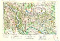
1984 Paducah
McCracken County, KY

1986 Paducah
McCracken County, KY

1987 Paducah
McCracken County, KY