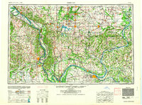
1964 Map of Paducah
USGS Topo · Published 1964About this map
The confluence of the Ohio River and the Mississippi River dominates this mid-century portrait of a vital tri-state river corridor. From the hub of Paducah in the south to the coal and rail centers of Marion and Harrisburg in the north, the map illustrates a landscape defined by heavy transit and water management. The massive Kentucky Reservoir and Crab Orchard Lake serve as anchors for recreation and resource control, while the Illinois Central and Louisville and Nashville railroads reveal the industrial backbone of Southern Illinois and Western Kentucky. This era shows the mature development of river towns like Metropolis, Cairo, and Shawneetown, alongside established conservation areas such as the Shawnee National Forest. The transition from the alluvial bottomlands near Powers Island to the interior Shawneetown Hills highlights the varied terrain that shaped early settlement patterns across these county lines.
Find a feature on this map
96 named features on this map. Tap any name to fly to it.
Don’t see what you’re looking for? This feature index may not catch every label — zoom into the map to look around manually.
Map Details
Editions of this 1964 Paducah Map
2 editions found
Other maps of this area

1903 · New Harmony
USGS Topo · 1:62,500

1903 · Patoka
USGS Topo · 1:125,000

1905 · Eldorado
USGS Topo · 1:62,500

1905 · New Haven
USGS Topo · 1:62,500

1906 · New Haven
USGS Topo · 1:62,500

1906 · Eldorado
USGS Topo · 1:62,500

1907 · Morganfield
USGS Topo · 1:62,500

1907 · Weingarten
USGS Topo · 1:62,500

1908 · Galatia
USGS Topo · 1:62,500

1908 · Princeton
USGS Topo · 1:62,500