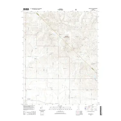
2015 Map of Paducah NE
USGS Topo · Published 2015About this map
Brookport and its surrounding countryside in Massac County are defined by a network of rural roads and family-named landmarks just north of the Ohio River. The landscape transitions from the developed edge of the river town into the protected boundaries of the Shawnee National Forest, where the terrain is carved by numerous small waterways like Barren Cr and Sevemile Cr. A high density of cemeteries, including the Brookport Cem, Pell Cem, and McCormick Cem, suggests a long history of local settlement and family homesteads across the plain. Notable natural and topographic features such as Buzzard Roost, Sycamore Plain, and Mill Spring dot the area, connected by long-established thoroughfares like Powers Church Rd and Azotus Rd. This survey provides a clear view of the rural infrastructure and land use in southern Illinois during the mid-2010s.
Find a feature on this map
64 named features on this map. Tap any name to fly to it.
Don’t see what you’re looking for? This feature index may not catch every label — zoom into the map to look around manually.
Map Details
Editions of this 2015 Paducah NE Map
This is the sole edition of this map. No revisions or reprints were ever made.
Other maps of this area

1916 · Golconda
USGS Topo · 1:62,500

1917 · Brownfield
USGS Topo · 1:62,500

1920 · Goloonda
USGS Topo · 1:48,000

1921 · Golconda
USGS Topo · 1:62,500

1926 · Paducah
USGS Topo · 1:62,500

1929 · Smithland
USGS Topo · 1:62,500

1929 · Paducah
USGS Topo · 1:62,500

1936 · Paducah
USGS Topo · 1:24,000

1936 · Smithland
USGS Topo · 1:48,000

1936 · Little Cypress
USGS Topo · 1:24,000