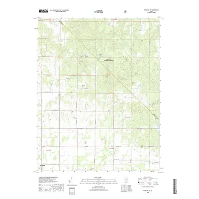
2018 Map of Paducah NE
USGS Topo · Published 2018About this map
Brookport sits along the southern edge of this Illinois landscape, which transitions from the developed river-adjacent outskirts into the protected woodlands of the Shawnee National Forest. The map reveals a dense network of family and community history preserved through over a dozen small burial grounds, including the Masonic Cem, Buzzard Roost Cem, and the Sycamore Plain Cem. The terrain is defined by a dendritic drainage system of creeks such as Sevenmile Cr and Barren Cr, which carve through the rural countryside north of the Ohio River. While the southern portion near Brookport Cem shows more structured road development like Unionville Rd, the northern reaches are dominated by timber and significant water bodies such as Mann Lake and Hohman Lake, illustrating the area's mix of managed forest and small agricultural holdings.
Find a feature on this map
61 named features on this map. Tap any name to fly to it.
Don’t see what you’re looking for? This feature index may not catch every label — zoom into the map to look around manually.
Map Details
Editions of this 2018 Paducah NE Map
This is the sole edition of this map. No revisions or reprints were ever made.
Other maps of this area

1916 · Golconda
USGS Topo · 1:62,500

1917 · Brownfield
USGS Topo · 1:62,500

1920 · Goloonda
USGS Topo · 1:48,000

1921 · Golconda
USGS Topo · 1:62,500

1926 · Paducah
USGS Topo · 1:62,500

1929 · Smithland
USGS Topo · 1:62,500

1929 · Paducah
USGS Topo · 1:62,500

1936 · Paducah
USGS Topo · 1:24,000

1936 · Smithland
USGS Topo · 1:48,000

1936 · Little Cypress
USGS Topo · 1:24,000