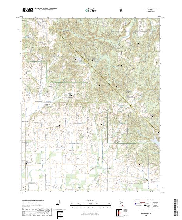
2024 Map of Paducah NE
USGS Topo · Published 2024About this map
Shawnee National Forest dominates the upper half of this modern terrain study, where the hills of Pope and Massac counties are densely packed with family-named burial grounds and historical landmarks. The landscape is defined by the winding paths of Barren Creek and Dog Creek, which cut through the timbered uplands. Genealogists will find an exceptional density of small, rural cemeteries such as Sycamore Plain Cem, Buzzard Roost Cem, and Dean Cem West, many situated along ridge roads like Riepe Ridge Rd. The southern portion of the map transitions into more level agricultural land, interconnected by a network of local thoroughfares including Unity School Rd and Unionville Rd, which tie together the legacy of early southern Illinois rural communities through persistent landmarks like Bigley Cem and Brookport Cem.
Find a feature on this map
62 named features on this map. Tap any name to fly to it.
Don’t see what you’re looking for? This feature index may not catch every label — zoom into the map to look around manually.
Map Details
Editions of this 2024 Paducah NE Map
This is the sole edition of this map. No revisions or reprints were ever made.
Other maps of this area

1916 · Golconda
USGS Topo · 1:62,500

1917 · Brownfield
USGS Topo · 1:62,500

1920 · Goloonda
USGS Topo · 1:48,000

1921 · Golconda
USGS Topo · 1:62,500

1926 · Paducah
USGS Topo · 1:62,500

1929 · Smithland
USGS Topo · 1:62,500

1929 · Paducah
USGS Topo · 1:62,500

1936 · Paducah
USGS Topo · 1:24,000

1936 · Smithland
USGS Topo · 1:48,000

1936 · Little Cypress
USGS Topo · 1:24,000