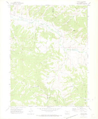
1971 Map of Pagoda
USGS Topo · Published 1974About this map
Williams Fork and its complex network of tributaries carve through the borderlands of Moffat and Routt Counties in this early 1970s survey. The landscape is defined by resource extraction and high-altitude water management, evidenced by numerous drill holes and the Cedar Creek Mine situated near Cedar Creek. The small settlement at Pagoda serves as a focal point along the Highland Ditch, while the surrounding terrain rises to landmarks like Daton Peak and the expanse of Oklahoma Flat.
Find a feature on this map
40 named features on this map. Tap any name to fly to it.
Don’t see what you’re looking for? This feature index may not catch every label — zoom into the map to look around manually.
Map Details
Editions of this 1971 Pagoda Map
4 editions found
Other maps of this area

1910 · Danforth Hills
USGS Topo · 1:125,000

1915 · Monument Butte
USGS Topo · 1:62,500

1916 · Daton Peak
USGS Topo · 1:62,500

1920 · Daton Peak
USGS Topo · 1:62,500

1954 · Craig
USGS Topo · 1:250,000

1957 · Craig
USGS Topo · 1:250,000

1958 · Craig
USGS Topo · 1:250,000

1960 · Craig
USGS Topo · 1:250,000

1962 · Craig
USGS Topo · 1:250,000

1964 · Craig
USGS Topo · 1:250,000