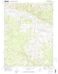
1971 Map of Pagoda
USGS Topo · Published 1974About this map
Williams Fork and its East Fork converge in this high-altitude corner of Northwest Colorado, where the 1970s landscape was defined by mountain ranching and resource extraction. The small settlement of Pagoda serves as a central point along the river valley, surrounded by a complex network of irrigation systems including the Peck Ditch, Highland Ditch, and Sullivan Ditch. These waterways support remote agricultural operations near Okkahoma Flat and local water storage at Sullivan Reservoir and Sagebrush Reservoir No 1.
Find a feature on this map
38 named features on this map. Tap any name to fly to it.
Don’t see what you’re looking for? This feature index may not catch every label — zoom into the map to look around manually.
Map Details
Editions of this 1971 Pagoda Map
4 editions found
Other maps of this area

1910 · Danforth Hills
USGS Topo · 1:125,000

1915 · Monument Butte
USGS Topo · 1:62,500

1916 · Daton Peak
USGS Topo · 1:62,500

1920 · Daton Peak
USGS Topo · 1:62,500

1954 · Craig
USGS Topo · 1:250,000

1957 · Craig
USGS Topo · 1:250,000

1958 · Craig
USGS Topo · 1:250,000

1960 · Craig
USGS Topo · 1:250,000

1962 · Craig
USGS Topo · 1:250,000

1964 · Craig
USGS Topo · 1:250,000