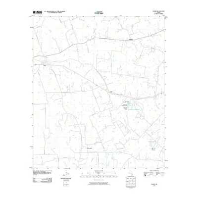
2010 Map of Paige
USGS Topo · Published 2010About this map
The community of Paige serves as a central point in this rural Texas landscape, where the local road network connects small settlements like Manheim, Hills, and Grassyville. The terrain is defined by a dense web of watercourses, including the ominously named Dead Mans Hole Creek and the meandering path of Rabbs Creek. Numerous small water bodies and dams, such as Hamff Lake Number 1 and Domaschk-Biar Lake, suggest a landscape managed for local agriculture and water storage. Historical access is represented by routes like Old Hwy 20 and various farm-to-market roads that link these dispersed homesteads. For genealogists and local historians, specific road names like Friendship Cemetery Rd, Church Rd, and August-Anna Rd offer clues to the locations of family landmarks and early community gathering places in Lee County.
Find a feature on this map
57 named features on this map. Tap any name to fly to it.
Don’t see what you’re looking for? This feature index may not catch every label — zoom into the map to look around manually.
Map Details
Editions of this 2010 Paige Map
This is the sole edition of this map. No revisions or reprints were ever made.
Other maps of this area

1885 · Bastrop
USGS Topo · 1:125,000

1893 · Bastrop
USGS Topo · 1:125,000

1904 · Bastrop
USGS Topo · 1:125,000

1919 · Giddings
USGS Topo · 1:62,500

1919 · Dime Box
USGS Topo · 1:62,500

1948 · Smithville
USGS Topo · 1:62,500

1948 · Lexington
USGS Topo · 1:62,500

1950 · Lexington
USGS Topo · 1:62,500

1950 · Smithville
USGS Topo · 1:62,500

1954 · Austin
USGS Topo · 1:250,000