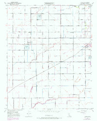
1950 Map of Paige
USGS Topo · Published 1971About this map
Atchison Topeka and Santa Fe rail tracks slice diagonally through this San Joaquin Valley agricultural landscape, anchoring the small settlement of Paige. The map reveals a highly engineered water management system essential for local farming, featuring the Tulare Canal, Cameron Creek, and numerous percolation basins. Education is decentralized across the rural territory, marked by several local institutions including Buena Vista Sch, Linder Sch, and Laurel Sch. Large-scale operations such as the Colpien Ranch and the presence of a specialized Water Sewage Disposal facility highlight the area's development into a productive industrial-scale farming region. The extensive grid of roads, from Cartmill Road to Waukena Road, facilitates the movement of goods and people across the flat valley floor toward nearby Tulare.
Find a feature on this map
36 named features on this map. Tap any name to fly to it.
Don’t see what you’re looking for? This feature index may not catch every label — zoom into the map to look around manually.
Map Details
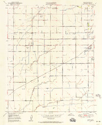
Editions of this 1950 Paige Map
2 editions found
Other maps of this area

1925 · Tulare
USGS Topo · 1:31,680

1925 · Tipton
USGS Topo · 1:31,680

1926 · Goshen
USGS Topo · 1:31,680

1927 · Remnoy
USGS Topo · 1:31,680

1927 · Lake View School
USGS Topo · 1:31,680

1927 · Paige
USGS Topo · 1:31,680

1927 · Visalia
USGS Topo · 1:31,680

1927 · Tulare
USGS Topo · 1:31,680

1928 · Tipton
USGS Topo · 1:31,680

1928 · Waukena
USGS Topo · 1:31,680