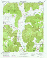
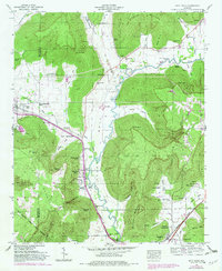
1948 Map of Paint Rock
USGS Topo · Published 1976About this map
The Paint Rock River carves a deep valley through the Jackson and Madison County line, serving as the central artery for this mid-century agricultural landscape. The Southern Railway and Lee Highway parallel the river, connecting the primary settlements of Paint Rock, Gurley, and Woodville. Notable for local history and genealogy, the map identifies numerous family cemeteries including Roberson Cem, Latham Cem, and Rousseau Cem, often tucked into the many coves like Bucks Pocket and Bingham Cove.
Find a feature on this map
65 named features on this map. Tap any name to fly to it.
Don’t see what you’re looking for? This feature index may not catch every label — zoom into the map to look around manually.
Map Details
Editions of this 1948 Paint Rock Map
5 editions found
Other maps of this area

1888 · Scottsboro
USGS Topo · 1:125,000

1892 · Scottsboro
USGS Topo · 1:125,000

1936 · New Hope
USGS Topo · 1:24,000

1936 · Moontown
USGS Topo · 1:24,000

1936 · Hollytree
USGS Topo · 1:24,000

1936 · Grant
USGS Topo · 1:24,000

1936 · Princeton
USGS Topo · 1:24,000

1936 · Lim Rock
USGS Topo · 1:24,000

1936 · Maysville
USGS Topo · 1:24,000
1936 · Swearengin
USGS Topo · 1:24,000