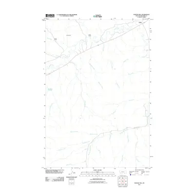
2011 Map of Painted Hill
USGS Topo · Published 2011About this map
Rosebud Creek and its many named tributaries carve through this landscape in Big Horn County, Montana. The drainage patterns of the northern Cheyenne region are well-defined here, showing the complex network of Killsnight Creek, Ridgewalker Creek, and Little Chief Creek as they flow north. The namesake Painted Hill rises between Rosebud Creek and Indian Coulee, while the southern reaches of the map are defined by the headwaters of Shavedhead Creek and Medicine-Elk Creek. This 2011 survey reveals the infrastructure of the area through Muddy Creek Rd and the presence of Two Moon Reservoir. The tiny settlement of Muddy anchors the northeastern corner near where the waters of Muddy Creek and Muddy Springs meet, providing a clear view of the rural Montana rangeland at the start of the decade.
Find a feature on this map
26 named features on this map. Tap any name to fly to it.
Don’t see what you’re looking for? This feature index may not catch every label — zoom into the map to look around manually.
Map Details
Editions of this 2011 Painted Hill Map
This is the sole edition of this map. No revisions or reprints were ever made.
Other maps of this area

1954 · Hardin
USGS Topo · 1:250,000

1957 · Hardin
USGS Topo · 1:250,000

1958 · Hardin
USGS Topo · 1:250,000

1958 · Chalky Point
USGS Topo · 1:24,000

1958 · Painted Hill
USGS Topo · 1:24,000

1958 · Bull Creek Lookout
USGS Topo · 1:24,000

1958 · Jimtown
USGS Topo · 1:24,000

1958 · Black Spring
USGS Topo · 1:24,000

1958 · Busby
USGS Topo · 1:24,000

1958 · Birdseye Spring
USGS Topo · 1:24,000